water trail MAP AND river ACCESS POINTS
Where Your Trip Begins
The Upper Cheat River Water Trail is an ongoing project. Its dynamic nature means that this site may change – such as improvement and addition of access points to info for businesses and amenities along the trail. The maps provided below will reflect the most up-to-date information, so be sure to check for new updates if you’re returning to the Cheat. Click on each map to see it larger.
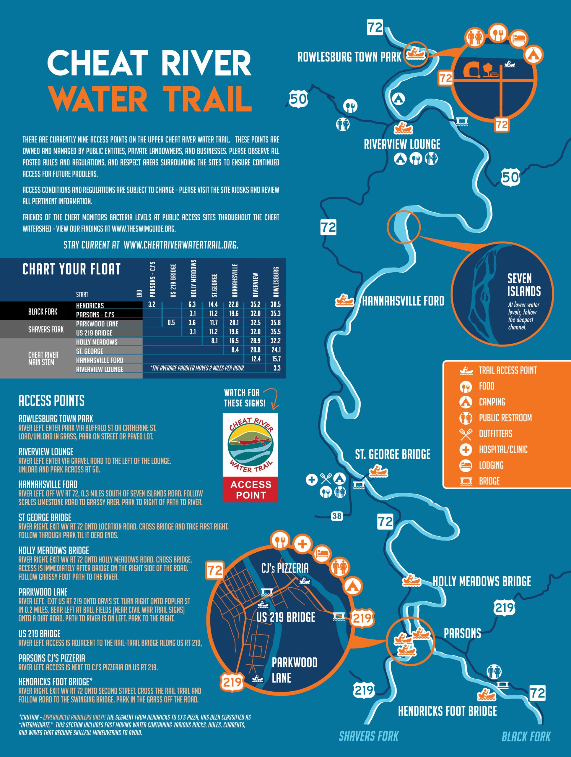
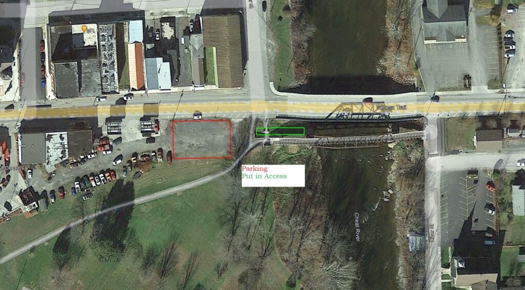
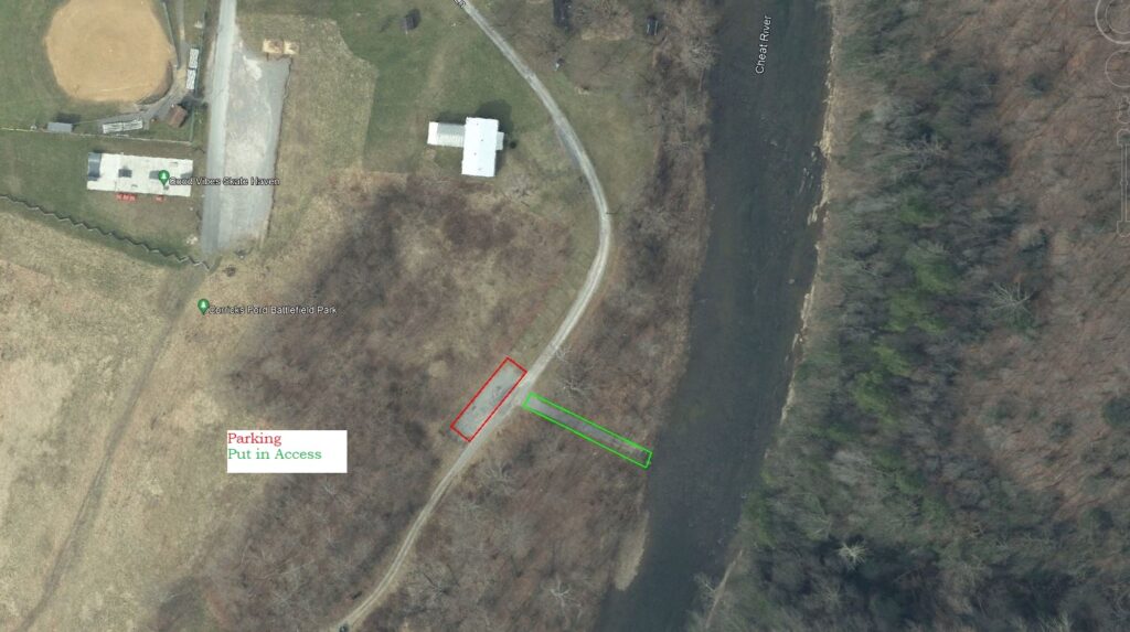
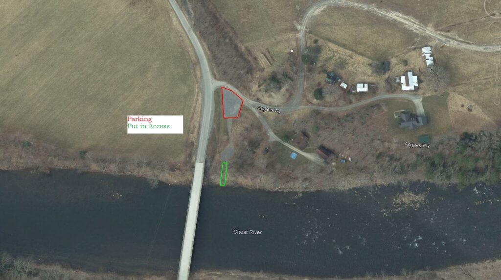
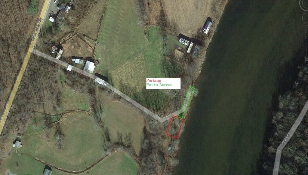
There are currently nine existing access points on the Upper Cheat River Water Trail. These sites are owned and managed by public entities as well as private landowners and businesses. Please observe all posted rules and regulations and respect areas surrounding the sites to ensure continued access for future paddlers.
THINGS TO KEEP IN MIND
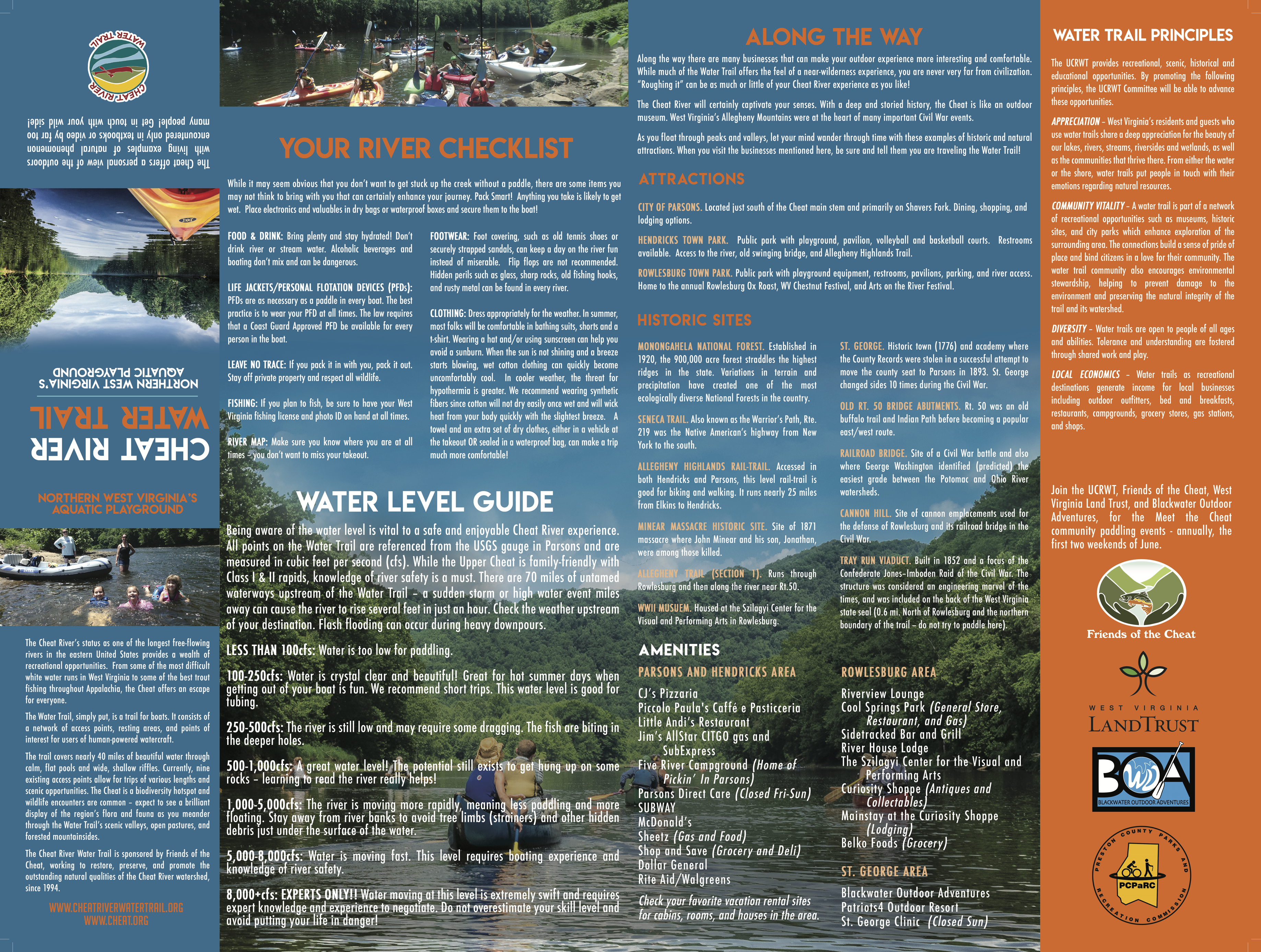
The Cheat River flows north, which surprises many visitors. Make sure to start your trip south of where you plan on taking out.
CAUTION – EXPERIENCED PADDLERS ONLY – The CRWT segment, Hendricks to The Fat Olive (formerly CJ’s Pizza), has been classified as “Intermediate.” This section includes fast moving water containing various rocks, holes, currents, and waves that require skillful maneuvering to avoid. Swimmers could be at risk and may require help.
The Black Fork at Hendricks and Shavers Fork in Parsons join to form the Cheat main stem. Travelers on the Water Trail may access the main stem from either fork.
River Access Point Information
HENDRICKS
Parsons – Parkwood Lane
Parsons – 219 Bridge
Holly Meadows Bridge
ST. GEORGE – DNR ACCESS

HANNAHSVILLE FORD
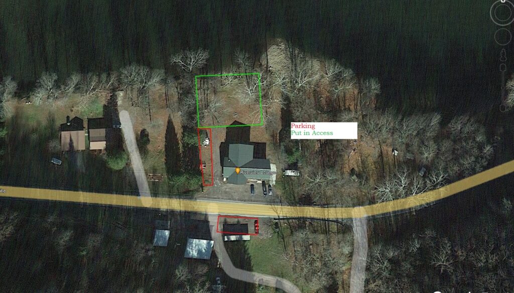
RIVERVIEW LOUNGE
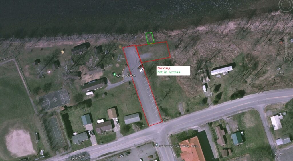
ROWLESBURG CITY PARK